Maps
The CRA currently relies heavily on the City of Cambridge for GIS services and other partners for informational maps about Cambridge and Kendall Square. Please find below current and historic maps relevant to the work of the CRA. Click on any of the small maps to view a slideshow of larger versions.
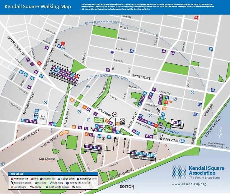

Kendall Square Association Walking Map
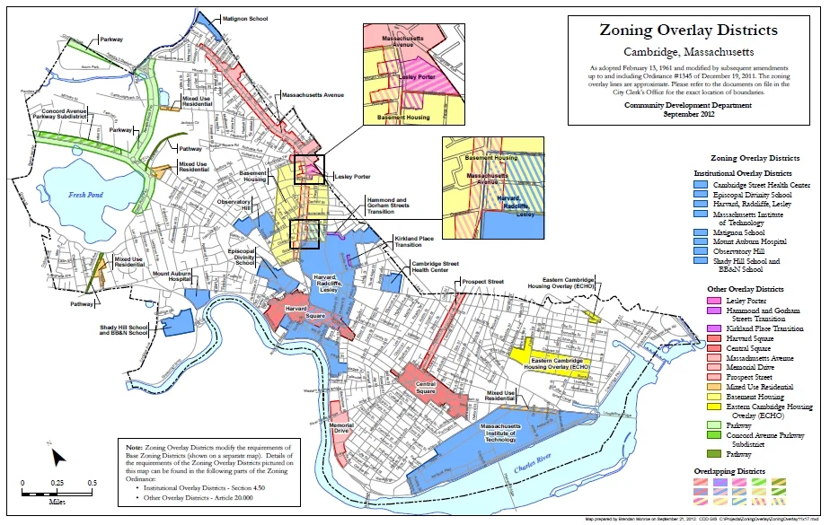
Cambridge Zoning Overlay Districts
Kendall Square on the MBTA System Map
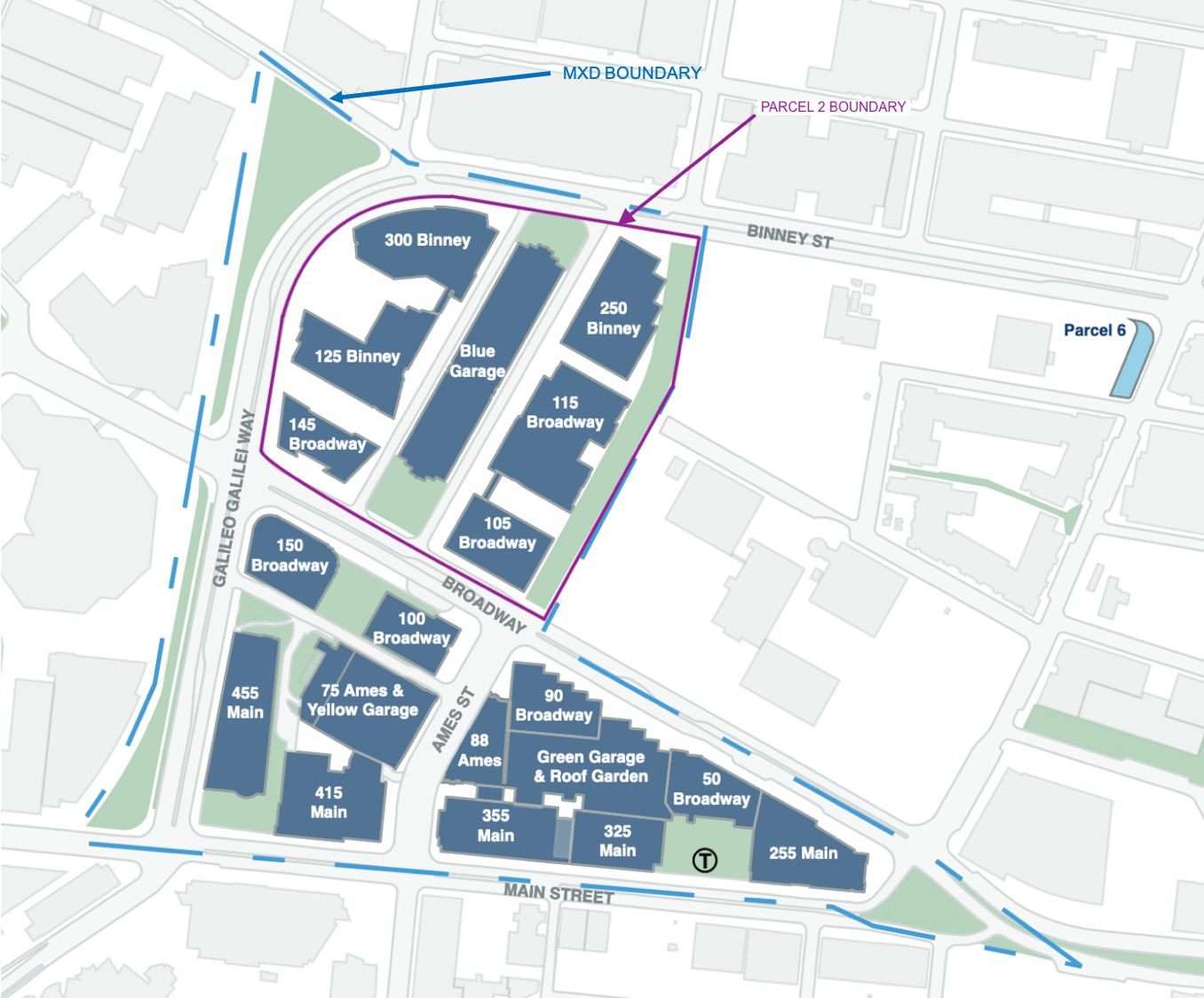
MXD and Parcel 2 Boundary
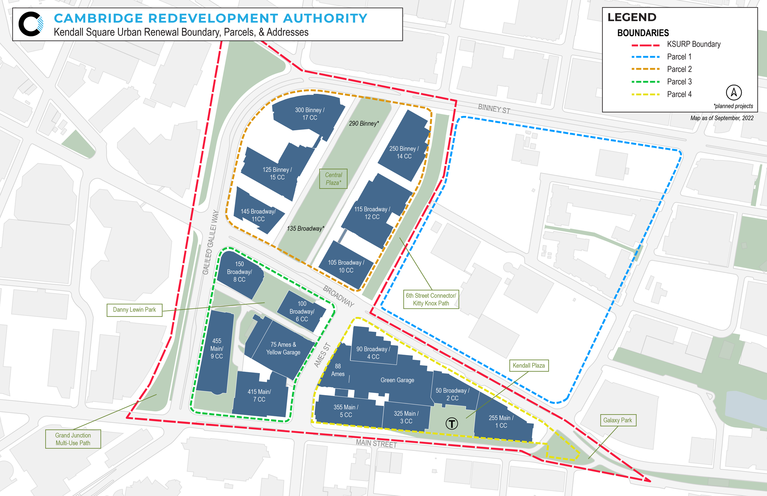
Parcel Boundaries